MBES can’t be IHO compliant and here is why

MBES and the IHO SP44 Standards for Hydrographic Surveys


The International Hydrographic Organisation, based in Monaco, published the 5th edition of Special Publication N44 Standards for Hydrographic Surveys in February 2008.  SP44 sets forth the minimum standards for survey accuracy.

By 2008, multibeam echosounders had been well established as standard equipment for hydrographic survey.  In that regard, SP44 is specific to hydrographic surveying — it contains nothing specific to multibeam echosounders.  Rather, SP44 is a standard developed by the IHO ‘to help improve the safety of navigation.’  SP44 concerns itself with depth accuracy. However, a multibeam echosounder does not measure depth; it measures range and bearing to the seafloor.

To be compliant with an S-44 Order a survey must be compliant with ALL (sic) specifications for that order included in these Standards.’ (IHO Standard for Hydrographic Surveys (S-44) 5th Edition February 2008, pg 3, International Hydrographic Bureau, Monaco)

When a manufacturer states that a multibeam echosounder meets IHO SP44 or a client states a multibeam echosounder must meet IHO SP44 on a project, they may not understand the specifics of IHO SP44.  SP44 looks at the total survey system:

It is also important to note that the adequacy of a survey is the end product of the entire survey system and processes used during its collection.’  Further: ‘All components and their combination (sic) must be capable of providing data to the required standard.”  (Ibid.)

What is the survey system comprised of (at a minimum)?

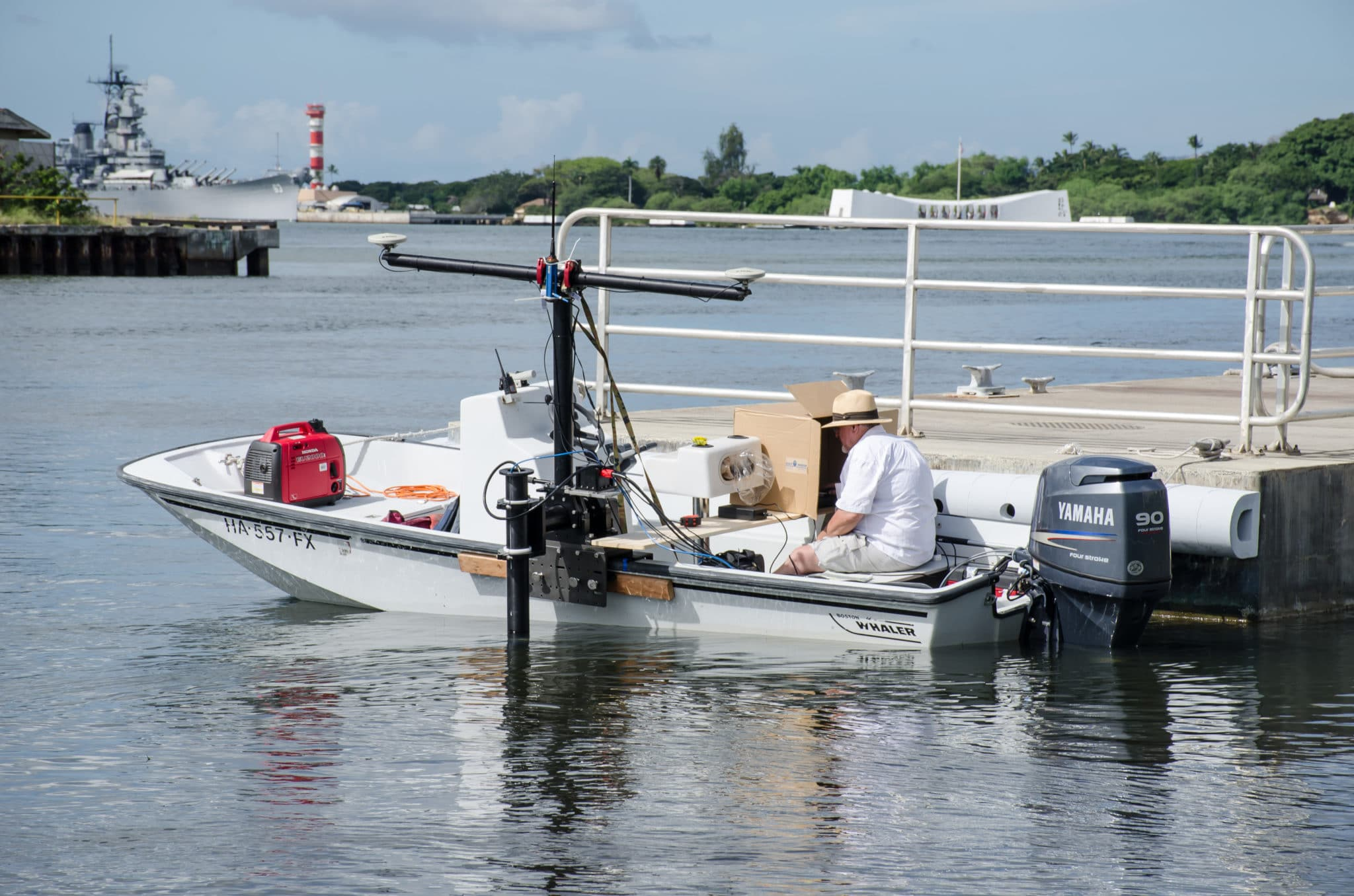
  1. Proper survey vessel
  2. Positioning system
  3. Motion sensor
    • Aligned with axes of vessel
    • Heave bandwidth adjusted properly
  4. Heading sensor
    • Aligned with the centerline of the vessel
  5. Multibeam echosounder
    • Properly mounted; if on a pole, there is no flexing or vibration
    • Properly calibrated (Patch test)
    • Operated properly
  6. Sound velocity profiler
    • Calibrated
    • Sufficient casts
  7. Tide gauge
    • Proximity to the survey area
  8. Offset measurements
    • Surveyed in using land survey techniques preferred
  9. Data collection and processing software
    • Software set up correctly including timing control
    • Software tools/windows enabled for quality control
  10. Skilled surveyors

As the list above shows, the multibeam is approximately 1/10 of the entire survey system, as used in IHO SP44. The depth computation relies on the other 9/10 of the survey system along with the multibeam echosounder.  The multibeam echosounder provides a range and bearing to points on the seafloor.  The data collection/processing software receives the range and bearing data along with position, heading, and motion data, makes offset adjustment, and applies refraction corrections and tidal corrections to produce a depth.  However, as an example, if the multibeam is mounted using a bamboo pole that wobbles, no matter how good that multibeam might be, no matter how good the other sensors are, the range and bearing data would be inaccurate due to pole wobble.  Or, if the sound velocity profiler is out of calibration, the refraction corrections would be inaccurate, causing erroneous depths.  These few considerations illustrate how the entire survey system must be evaluated for IHO SP44 order survey compliance.

Compliance with IHO SP44 Special Order (or Order 1a, 1b, or 2) can be proven for a survey system comprised of a multibeam echosounder by performing a set IHO survey for that specific vessel and that specific survey system and setup.  However, changing any component would invalidate compliance.

Another aspect of the IHO SP44 standards is the horizontal uncertainty (2ẟ) that is allowed: 2 meters.  If the IHO standard allows for a horizontal position error of this magnitude, how accurately is the depth positioned on the seafloor?

Feature Detection: IHO SP44 Special Order calls for the system to detect a 1-meter cubic feature.  What the IHO SP44 does not state, however, is what constitutes detection. How many soundings determine detection?

There are other survey standards that better address the modern-day multibeam survey, such as the LINZ produced Contract Specifications for Hydrographic Surveys (Version 1.3; 2016).

The main point is that there are many components in a survey system, and it is the survey system that will determine compliance with IHO SP44 survey order specifications. One component of the survey system cannot be singled out, such as the multibeam echosounder.

When installed following the instructions from the R2Sonic manual and used with the I2NS and Sound Velocity options offered by R2Sonic, the Sonic series not only meets but exceeds SP44 requirements.

Tips for surveying over soft & muddy bottoms

Many surveys are in areas that are less than ideal for acoustics.  These types of areas have seafloors that are soft and comprised mostly of mud as opposed to sand or gravel.

The multibeam transmitter emits an acoustic pulse that reflects mostly off of the bottom and back to the multibeam receiver.  In areas of sand or gravel much more of the acoustic energy is reflected back to the receivers.  In areas of mud or soft bottom a large portion of the acoustic energy is absorbed by the soft seafloor so much less energy is returned to the receivers.  The soft bottom will also cause more refraction and scatter the acoustic return, which will reflect off of the water surface and bounce back to the sea floor before being reflected to the receivers; this causes a second return and can even cause a tertiary return.

The Acoustic Imagery should always be turned on (Display settings) as this will give the surveyor a good indication of the reflectivity of the sea floor (brighter colors). The stronger the return the more energy will be seen.  The Acoustic Image will also make it easier to see if a second return is causing an issue, in which case the use of the gates will eliminate the second return interference. Another tool is the Saturation Monitor, which shows the actual receiver intensity level.

To overcome bottom absorption, in soft areas, a little basic acoustic theory helps.  The acoustic pulse is always at a certain frequency.  Frequency is the number of cycles per second; the more the cycles per second the more damage is done when the cycles are interrupted.  400kHz has twice as many cycles per second as 200kHz so more attenuation is seen at 400kHz even when the power level is the same for both frequencies.

Lower frequencies provide a better swath when surveying soft bottoms; there is less bottom absorption and less signal attenuation.

It is important to keep in mind the relationship between Power and Pulse width.  Power is the amplitude of the transmitted pulse, whereas pulse width is the length of time the pulse is being transmitted.  In soft bottom areas, increasing the amplitude does not do much good, whereas increasing the length of time the pulse goes into the water does by getting more total power to the outer beams.

Therefore, in soft areas, increase the Pulse Width first before increasing Power.

In the Saturation Monitor, the increased Pulse Width will show stronger outer beam energy, which translates to better swath coverage.

MultiSpectral versus Multifrequency Backscatter: A Generational Advancement

Multibeam Backscatter is a tool used in seafloor characterization, and R2Sonic‘s recent MultiSpectral Backscatter advancement dramatically improves this process.  MultiSpectral Backscatter comprises two or more frequencies collected in one-pass using an advanced sonar capable of multifrequency transmissions, either interleaved or simultaneous.

MultiSpectral Backscatter should not be confused with MultiFrequency Backscatter

Older sonars can collect Multifrequency Backscatter by passing over the same area multiple times using a different single frequency in each pass, whether using the same or different sonars. The difference between the two definitions above is far more than semantics.

The amount of acoustic energy the seafloor returns to a sonar depends on several factors, including sediment type, sonar frequency, sonar characteristics (radiometric), and grazing angle (geometric). Using different frequencies on the same patch of seafloor results in different backscatter responses enabling better seafloor characterization potential. However, using an older, single-frequency sonar results in a grazing-angle change due to multiple passes, exponentially complicating a potential characterization solution. Using different sonars at different frequencies cannot eliminate the grazing-angle problem even if sonars are normalized to reduce radiometric effects.

From Huff, Acoustic Remote Sensing as a Tool for Habitat Mapping in Alaska Waters

MultiSpectral Backscatter, collected with R2Sonic sonarsremoves the geometric and radiometric problems inherent with MultiFrequency Backscatter collected by older, less capable sonars regardless of whether or not they are normalized.


R2Sonic’s unique and patented “OnePass” approach allows the end user to collect the highest quality and reliable MultiSpectral Backscatter data in the most efficient manner, dramatically reducing the time, cost and complexity over alternate methods.


References:

  • Brown, C.J. et al., 2019, Multispectral multibeam echo sounder backscatter as a tool for improved seafloor characterization, Geosciences, MDPI, 19pp.
  • Huff, L., 2018, Acoustic Remote Sensing as a Tool for Habitat Mapping in Alaska Waters. Marine Habitat Mapping Technology for Alaska, 18pp.
  • Hughes Clarke, J.E., 2015, Multispectral Acoustic Backscatter from Multibeam, Improved Classification Potential, Proceedings of the United States Hydrographic Conference, The Hydrographic Society of America, 17pp.

Focus on what matters to you when reviewing a spec sheet

Multibeam echosounders are defined by technical features that are specific to acoustic devices. Some of the technical terms may not initially be intuitive even to surveyors.

The objective of this document is to define each technical term to help you understand the importance and implication of each of those concepts in the context of a hydrographic survey.

Spec Sheet Aid